Facts & figures about Lake Achensee
How deep is Lake Achensee? How many hiking trails are there in the region? Can you go skiing in the region? What are the most popular outdoor activities? Read our facts & figures to get an overview of Tirol's Sports & Vitality Park.
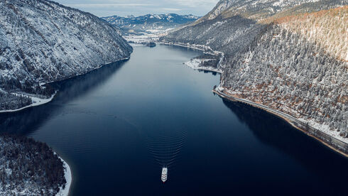
Lake Achensee is a natural lake created by glaciers.
- Volume – water content: 481 million m³
- Surface area: 6.8km²
- Length: 9km
- Maximum width: 1.3km
- Maximum depth: 133m
- Circumference: 21.3km
- Earth’s curvature: 1.38m
- Theoretical water renewal: 1.9 years
- Formation: some 20,000 years ago as a terminal moraine-dammed lake after the last Ice Age
- Water quality: very good - drinking water quality!
- Surface area of the entire Achensee region: 390km²
In Austria and hence in the Achensee region, the standard time is Central European Time (CET; UTC+01:00). Austria also observes daylight savings time (CEST).
Austria belongs to the transitional central European climatic zone, which is characterized by warm summers and cold winters. Average temperatures in July are around 20 degrees Celsius, in winter around 0 degrees Celsius. Maximum temperatures in summer are around 35 degrees Celsius. In winter, temperatures can drop to -20 degrees Celsius.
Visit our live info page to view the current weather forecast for the next few days. Follow this link to learn more about the climate in Austria.
In Austria, tourists are required to pay an overnight accommodation tax which is charged according to the region they're staying in. In the Achensee region, the tourist tax is EUR 3 per night and person and is always billed separately. Exempt from the tourist tax are children staying overnight until the end of the calendar year in which they reach the age of 15 years.
In hotels and restaurants, prices are inclusive of taxes and service charges. Leaving a tip of 10% is common.
The currency in Austria is the euro. 1 euro = 100 cents.
- 01 & 06 January: New Year's Day & Epiphany
- Easter Monday
- 01 May: Labour Day
- Ascension Day
- Whit Monday
- Corpus Christi
- 15 August: Assumption of the Virgin Mary
- 26 October: Austrian National Holiday
- 01 November: All Saints' Day
- 08 December: Immaculate Conception
- 25 & 26 December: Christmas
Police: 133
Fire brigade: 122
Ambulance: 144
Mountain rescue – emergency number for alpine accidents: 140
Total kilometres of hiking trails: 500km of waymarked hiking trails
- Easy trails: 114km
- Moderately difficult trails (red): 285km
- Difficult trails (black): 101km
- Tallest mountain of the Achensee holiday region: Sonnjoch in the Karwendel mountains (2,457m)
- Plan your hiking tours with our interactive map at maps.achensee.com
The largest contiguous nature reserve in the northern limestone Alps and Austria's biggest nature park.
- Total area: 739km² (incl. Bavarian part: 930km²)
- The toll road into the Karwendel valleys (Falzthurn and Gerntal) is open from 18 April 2025 to 09 November 2025. It is closed to cars in the remaining months. Prices & detailed information can be found on the official website of the Karwendel Nature Park.
- Questions about the toll fee: Tel.: +43 681 84701090 or +43 664 5101381
- Total amount of cycling and MTB routes: over 320 kilometres
- Find your favourite cycling routes with our interactive map at maps.achensee.com.
- blue: 40,2km
- red: 251,8km
- black: 29,4km
- Long-distance cycle route münchen venezia: From Munich via Lake Achensee to the Adriatic Sea - Total length: 560km
- Lake Achensee is popular e-biking region: Rental stations (sports shops) + e-bike village Wiesing. Follow this link for more information.
- Total length of our 22 running routes: 183km
- blue: 26.5km
- red: 78.5km
- black: 78km
- Find your favourite running routes with our interactive map at maps.achensee.com.
- Karwendel cable car in Pertisau, www.karwendel-bergbahn.at
- Rofan cable car in Maurach, www.rofanseilbahn.at
- Posthotel Alpengolf in Achenkirch, www.posthotel-alpengolf.at
- Golf- und Landclub Achensee in Pertisau, www.golfclub-achensee.at
Follow this link for information on recreational fishing in summer.
- Number of crags/climbing areas (incl. alpine terrain): 13
- Number of via ferratas: 9
For more information, visit www.climbers-paradise.com/achensee - Find your favourite climbing routes with our interactive map at maps.achensee.com.
- Hochalmlifte Christlum in Achenkirch – 27km – blue: 6km, red: 16km, black: 5km
- Rofan cable car in Maurach – 11km – blue: 1km, red: 8km, black: 2km
- Karwendel cable car in Pertisau – 12km – blue: 6km, red: 6km
- Planberg and Wiesen lifts in Pertisau – 1 km – blue: 1 km
- Rofan lifts in Steinberg – 1km – blue: 0,3km, red: 0.7km
- Astenberg Lift in Wiesing – 1km – blue: 1km
Total amount of skiable terrain: 53km of slopes
- blue: 15.3km
- red: 30.7km
- black: 7km
The entire Achensee region has 28 lifts.
- Achenkirch: 27 kilometres of slopes
- Maurach: 5,6ha with snow-making capability - 2 kilometres of slopes
- Pertisau: 1 kilometre of slopes
- 228.5 kilometres of trails: classic and skating
- 116.5km of classic trails: 26km black | 41km red | 49.5km blue
- 112km of skating trails: 26km black | 41km red | 45km blue
- 40km of trails with snow-making capability in Achenkirch, Maurach and Pertisau
- 45km of adaptive cross-country skiing trails
- 2km of dog-friendly trails in Pertisau
Find all cross-country ski trails in our interactive map at maps.achensee.com.
- Achenkirch: 1 toboggan run – 3.5 km, Christlum toboggan run, floodlit on Wednesdays only
- Maurach: 1.5km, floodlit
- Pertisau: toboggan run Pertisau: 1,5km floodlit & toboggan run Zwölferkopf: 4.8km
- Steinberg: 800m, illuminated
- Wiesing: 3km, Breitlahn Rodelbahn floodlit
- Find all toboggan runs in our interactive map at maps.achensee.com
- Total amount of winter hiking trails: over 150 km
- Find all cleared winter walks in our interactive map at maps.achensee.com.
- Ice rink in Maurach
- Ice rink in Achenkirch
Snow biking, snowkiting, snowboarding, snowshoeing, bag jump, horse riding, kitesurfing, inline skating, climbing, paragliding, SUP, Nordic walking, beach volleyball, tennis and more!


